National geospatial data fund |
For the purposes of centralized accounting, keeping and use of topographical, geodetic and mapping documents there has been created State Cartographical and Geodetic Fund storing the respective materials for the whole territory of the Republic of Moldova. These materials are of technical, scientific, economic, historical, social and cultural interest.
Topographical, geodetic and mapping materials and data are distributed for use to public authorities and private sector on demand, observing the Fund Regulations.
Visit our facebook page.
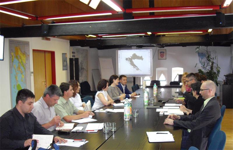
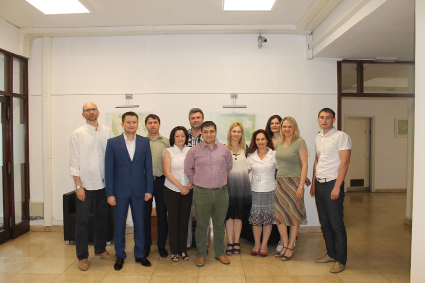
During the period 1-7 June 2015, a second study visit was conducted within Component 2 of the “Twinning Project for Agency for Land Relations and Cadastre – Organization, streamlining and computerisation of mapping process in R. Moldova “, financed by the European Union. The study visit was held at State Geodetic Administration from R. Croatia (junior project partner) by the R. Moldova’s delegation composed of two representatives of Agency for Land Relations and Cadastre and one representative from each of the following institutions: SE “State Roads Administration”, SE “Cadastru”, Institute for Forestry Research and Planning, Agency “Apele Moldovei” and National Bureau of Statistics. All above mentioned organisations are part of the working group for implementing the Twinning project and agreed to participate in project activities within Component 2, having as a mandatory result – demonstration of a regional Spatial Data Infrastructure on a pilot-district in R. Moldova.
During the
study visit, the participants were acquainted with the activity of State
Geodetic Administration from R. Croatia, studied the practical way of
establishing and operating the National Spatial Data Infrastructure (NSDI) from
this country, and had several meetings with other state institutions which are
participants (subjects) to Croatian NSDI: Ministry of Constructions and
Physical Planning, Rural Payments Agency for Agriculture, Zagreb City Office,
Faculty of Geodesy of Zagreb University. The specialised information systems of
these institutions have been studied and a live demonstration of how these
systems connect and are part of Croatian National Spatial Data Infrastructure
was shown.
The representatives of Moldovan delegation benefited from numerous presentations and explanations with regard to: evolution of NSDI from early beginning to the current stage, existing cadastral system in Croatia, official cartography, geoportal of State Geodetic Administration and geoportal for National Spatial Data Infrastructure, projects for land use and strategic planning of Zagreb city, metadata and network services, future plans for development. Special attention was devoted to coverage of projects and financing tools which SGA benefited from during the pre-accession period, as well as after joining the European Union, in order to develop NSDI components (geoportal, metadata, services, cooperation, etc.). Additionally, State Geodetic Administration, as representative of R. Croatia, is involved in a complex project entitled “IMPULS”, which is implemented by 6 countries from Western Balkans and which aims to develop the trans-boundary Spatial Data Infrastructure among these countries. Croatian experts presented numerous useful recommendations for Moldovan colleagues and encouraged the establishment and promotion of NSDI at the country level, concluding that the benefits from implementing NSDI in R. Moldova will be much superior and visible as compared to the costs.
The joint participation of representatives from Moldovan stakeholders, selected for implementation of regional SDI, has hopefully strengthened the cooperation among them. The participants have gained a broader understanding of NSDI and had a wonderful opportunity to see good examples of how to cooperate, which, in turn, will result in greater sharing of their information and increase in the overall use of spatial information in the Moldovan society.